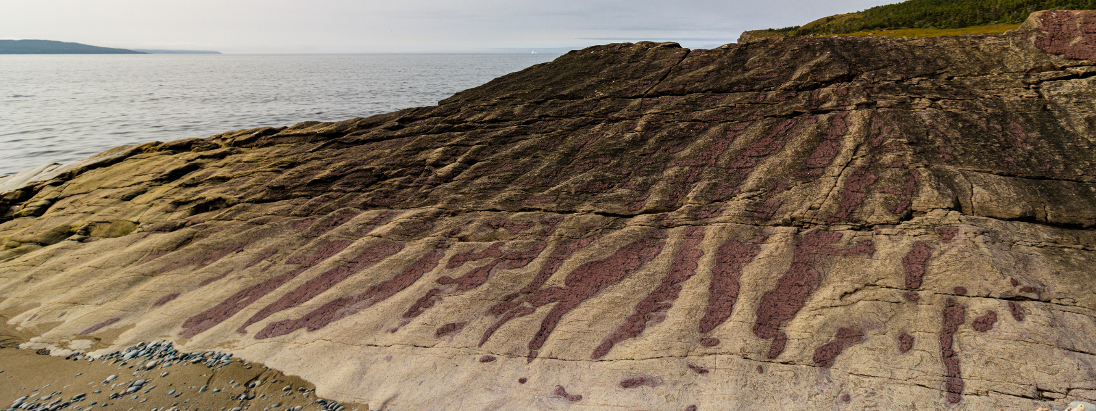
These rocks preserve a 550-million-year-old Ediacaran environment where a volcanic mountain range, located south of the equator, was slowly eroded by rivers and rain. This produced silt, sand and gravel that accumulated in the adjacent shallow seas. The movement of water in this shallow sea produced ripple marks in these sediments as they were moved forward and backward by the to-and-fro activity of water along the seafloor. These raised ridges were periodically smothered by layers of mud and ash produced by the still-active volcanoes, forming alternating layers of volcanic ash and coarser, erosive sediments. Most of the ripples here are symmetrical, suggesting they were formed by bi-directional water flow caused by waves. A cross-section through symmetrical ripples shows sediments arranged in oppositely inclined sedimentary layers; asymmetrical ripples (formed by unidirectional flow in rivers) show planar cross-bedding leaning in the direction of the current.
Getting Here
The Ripples Geosite is located on the coastal side of Route 235 near Hodderville, between the Geosites located in King’s Cove and Bonavista.